Map of the Charted Rooms
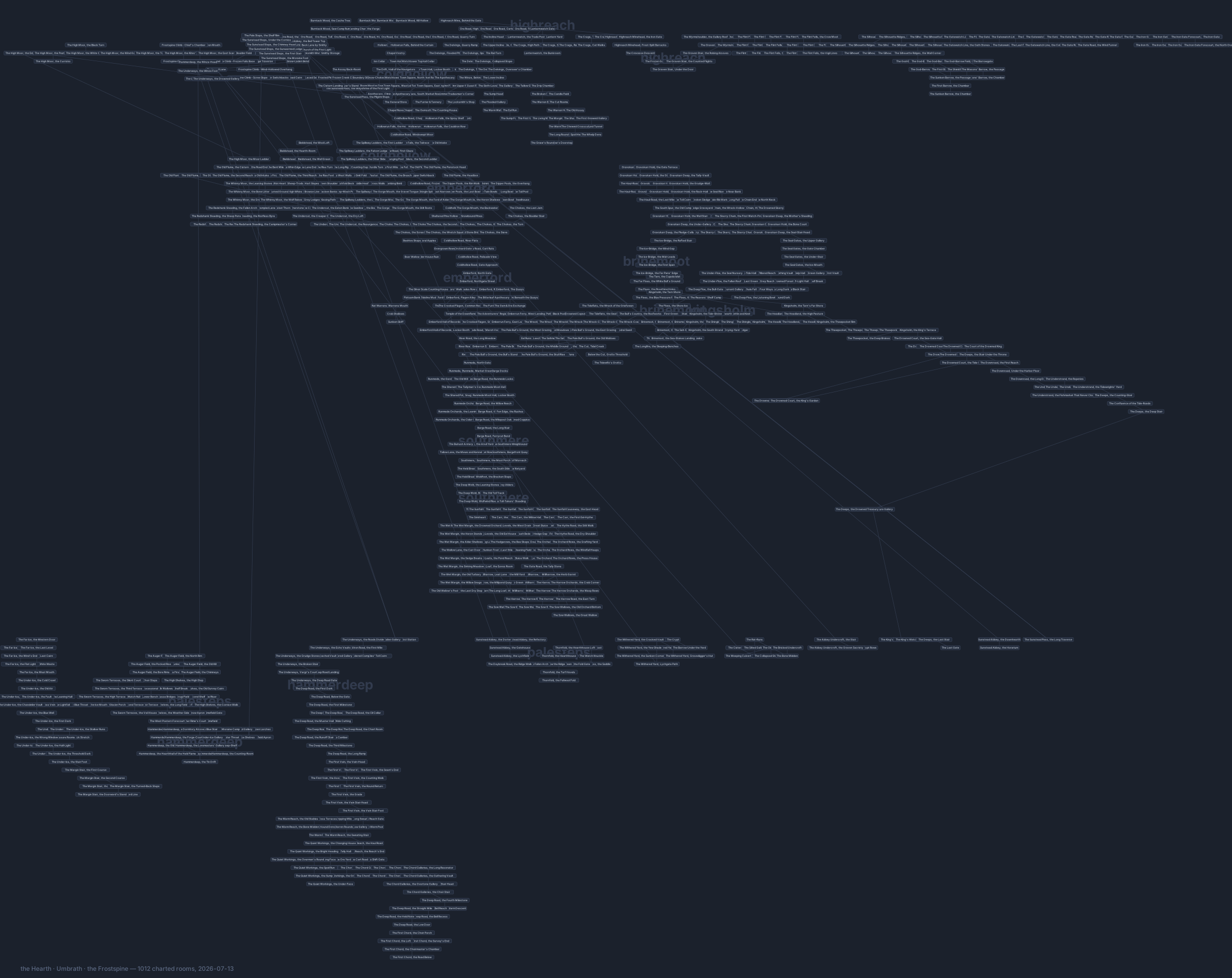
Every charted room in the Frostspine, drawn from the world itself — the towns, the roads between them, the hunting grounds, the deep ways, and the far coasts. Each small box is a room you can stand in; the lines are the ways between them. The long, lonely diagonals are the great crossings: the ferry over the Emberrun, the waygates, and the sea-lanes out to the drowned isle.
This is a topological travel chart on a geographic regional frame, not a scaled projection. Cardinal exits are authoritative bearings: a long chain of east exits really does establish an eastward route. Worldbuilder's Geographic layout keeps those local compass shapes, then places regional clusters on the same canonical bearings as the atlas. Distances still compress, roads may switch back, interiors share the canvas, and a scheduled voyage occupies no more graph space than a doorway. For coastlines, climate, watersheds, and physical relief, use the geographic atlas of the Hearth and Umbrath.
Open the full map — it is large. Open it in its own tab and zoom; every room is labeled, and hovering a room shows its name.
Reading the room chart
- Region names float behind their territory: Coldhollow, Emberford, Southmere, Brinemoot, Hammerdeep, Kingsholm and the rest. The World chapters describe each in full.
- What is missing is missing on purpose. The Frostspine keeps its secrets: hidden ways and the rooms behind them are not drawn. If a passage exists that this map does not show, that is what
SEARCHis for. - The map is a survey, not a promise — new ground is charted every season, and the footer records how many rooms were known the day it was drawn.
The living map
The web HUD carries a live version of this map that follows your character as you move, room by room, with a mini-map beside your game window. If you play through the HUD you already have it.
Worldbuilder also retains a Topology layout button for compact link-first diagnostics. That mode has no continental anchors and should not be published as the official world arrangement.
For builders, the same graph can be colored without rearranging it: biome, elevation, travel time, route class, and transport overlays show why two adjacent-looking nodes may represent very different journeys. A ferry deck remains a topology link; the transport overlay makes clear that it is not a road.
The current long-form layer adds 231 route, refuge, town, and branch rooms across seven official corridors, including the 42-mile Coldhollow Road, the 34-mile Sunfall Causeway, and the 18-mile Sunward Road. Forty-two connected civic interiors open the institutions of Runmede, Brinemoot, Kingsholm, Southmere, and Millharrow; Aldermouth adds its own working market, relief, and pilot rooms. The compressed links remain as learned shortcuts, so the chart records both quick travel and the country available to explore between towns.
For a readable town-by-town view, the Regional Atlas pairs geographic area plates with exact room schematics and puts creature level bands only on the signed hunting branches where those creatures actually live. For progression, The First Fifteen, Three Roads After Fifteen, and Roads Beyond Thirty turn that same graph into staffed, level-banded routes without inventing connections between separate fronts.
GM note: after changing geography, publish the anchor room vars, choose
Geographic layout and Save layout in Worldbuilder, then run
py tools/audit-geography.py. Master deployment re-renders the room SVG from
the saved live graph after guarded content publication and bind-mounts it into
the wiki; py tools/render-world-map.py remains the local/manual equivalent.
Hidden ways and secret rooms are withheld automatically.